
Miros Launches 3D Vessel View For Sea-State Monitoring
Miros, a Norwegian specialist in radar-based real-time ocean surface measurement, has introduced a 3D vessel view providing crews and operators with a consolidated view of the accurately measured sea state surrounding their vessel. The…
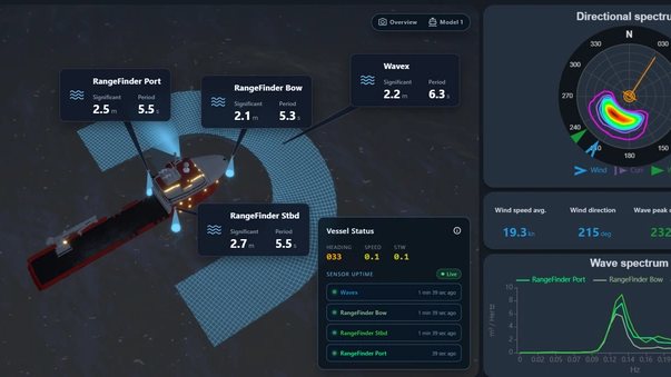
Miros, a Norwegian specialist in radar-based real-time ocean surface measurement, has introduced a 3D vessel view providing crews and operators with a consolidated view of the accurately measured sea state surrounding their vessel.
Wave conditions can differ around a vessel due to wave direction, vessel heading, hull geometry, shielding, and measurement location. Where multiple measurement sources are installed, comparing readings can help teams clearly understand differences between measurement areas and sea conditions affecting specific working areas.
Bridge and deck crew can easily assess conditions port and starboard, check the waves at a specific working area such as a gangway or ROV launch point, and spot differences between measurement areas before they affect the operation, turning a weather-critical operation into a controlled one.
The visualization shows measurement sources, areas, and values in relation to the vessel. It does not represent a reconstructed 3D sea surface.
This story was originally published by MarineLink. Read the full story at MarineLink →


Conversation