
Oil Spill Off UAE Widens, Satellite Images Show, Prompting More Beach Closures
An oil spill from a damaged tanker off the coast of the United Arab Emirates has widened, satellite images showed, triggering more beach closures and raising environmental concerns.
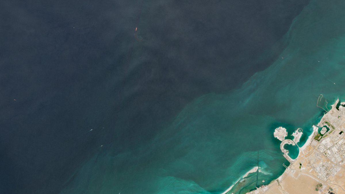
DUBAI, Oct 26 (Reuters) – An oil spill from a damaged tanker off the coast of the United Arab Emirates has widened, satellite images showed, triggering more beach closures and raising environmental concerns.
Images from the European Union’s Copernicus satellite observation network dated October 24 show the oil spill has widened over the last few days and is reaching close to the shores of the northern Umm Al Quwain emirate, with dark layers of oil spreading at sea and along its coastline.
Since the start of the US-Israeli war with Iran, attacks on commercial vessels in Gulf shipping lanes have driven up security risks for maritime traffic and heightened fears over the conflict’s environmental fallout.
October has been the worst month for attacks on commercial shipping in the Strait of Hormuz and nearby waterways, according to data compiled by the Washington Institute for Near East Policy think tank.
This story was originally published by gCaptain. Read the full story at gCaptain →

Conversation